
Yukon: Alpine Patterned Ground, Mount Hare, Yukon, Canada
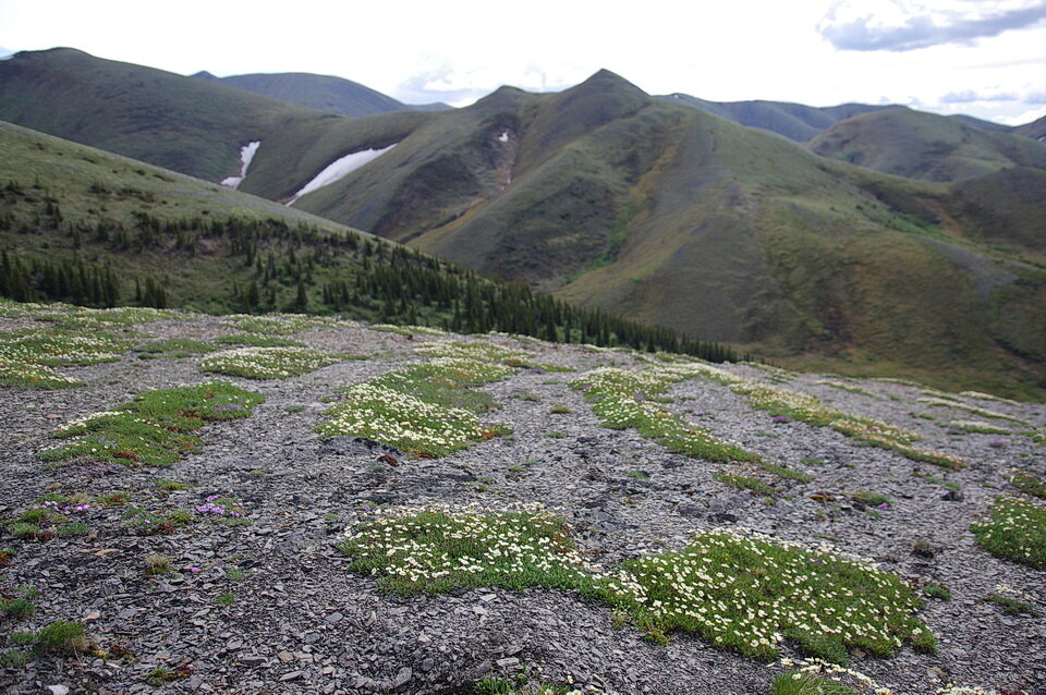
Photo 1: While hiking in the subalpine of Mount Hare, on a sloped rocky ground of frost-shattered rock, it is not uncommon to see bands or stripes of broken rock that were slightly elevated above the adjacent ground. Mountain Avens grow on the slightly raised ground. What is that pattern? Photo composed by Andy Fyon, in the Mount Hare area, east of the Dempster Highway, central Yukon, Canada, June 14, 2019.
Patterned Ground
What are those patterns I see formed by broken rock seen in the subalpine in the Mount Hare area, east of the Dempster Highway, central Yukon, Canada? I am not an expert on the features that I will describe, but I will relate the descriptions to possible explanations based on published studies in the geological literature.
Two Features
Two features are developed on the crumbly subalpine slope (Photo 1): a) broken, thin, rock pieces; and b) subtle, raised ridges of broken rock that are about 0.5 m wide and 20 cm high. Each of these features likely formed by different geological processes.
Broken Rock Chips
The broken rock surface is common in the subalpine and alpine of this area (Photo 2).
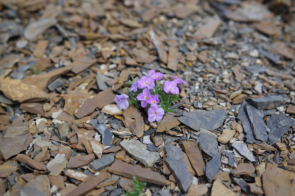
Photo 2: Broken pieces of shale rock dominates the surface of the slope in the subalpine in the area of Mount Hare. The pink wildflower is Alaska Phlox (Phlox richardsonii ssp alaskensis). Photo composed by Andy Fyon, in the Mount Hare area, east of the Dempster Highway, central Yukon, Canada, June 14, 2019.
There are likely two processes that created the broken, crumbly rock on surface: a) the bedrock consists of the sedimentary rock called shale. Shale is a weak rock because it consists of many thin, flat layers that lie on top of each other - like pages in a book. Typically, shale breaks apart along those flat layers because of the natural weakness that exists between the surfaces of the layers. So, the very nature of the rock is one factor that leads to the creation of the thin, broken rock pieces on surface (Photo 2).
Because the slope is developed in the subalpine and alpine, in an area where glaciers occurred in the past, there was likely a second process that enhanced and accelerated the creation of the rock chips. The second process is called frost shattering. Frost shattering happens when water freezes in cracks or surfaces within a rock. When water freezes into ice, it expands. Expanding ice applies pressure of the enclosing rock, which causes the rock to break apart by a process called mechanical disintegration. Frost shattering likely enhanced and accelerated the creation of the broken shale rock pieces.
So, the broken rock chips (Photo 1 and 2) on the crumbly surface of the slope likely formed as a result of the natural weakness of the layered shale rock and as a result of frost shattering.
Raised Ridges
On this slope, bands or stripes of broken rock were common (Photo 3). The raised stripes were slightly elevated above the adjacent ground. The raised stripes looked like waves on a lake. By elevated, I mean each rock stripe was less than a metre wide and less than 20 cm higher than the surrounding ground (Photo 3).
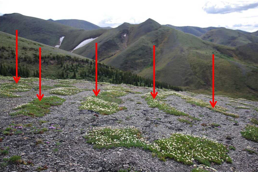
Photo 3: The red arrows point to a series of rock ridges, or stripes, made from the broken shale chips. The ridges were less than one metre wide and less than 20 cm higher than the surrounding ground. The white-coloured Mountain Avens (Genus Dryas) grew preferentially along the top of each stripe. Photo composed by Andy Fyon, in the Mount Hare area, east of the Dempster Highway, central Yukon, Canada, June 14, 2019.
The ridges ran for several metres to 10’s of metres in length. On an exposed slope, you could see many ridge bands that ran across the slope of the ground and some that ran down the slope, highlighted by preferential growth of white-coloured Mountain Avens (Genus Dryas) (Photos 3 and 4).
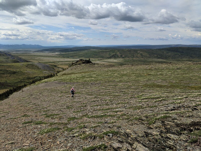
Photo 4: Many raised ridges, or stripes, are developed at approximately right angles to the slope of frost-shattered shale. White-coloured Mountain Avens (Genus Dryas) grow preferentially along the top of the ridge. Photo composed by Andy Fyon, in the Mount Hare area, east of the Dempster Highway, central Yukon, Canada, June 14, 2019.
The Dryas plants discontinuously outlined the crest of the rock stripe and was especially noticeable on the ridges that ran across the slope (Photo 3 and 4). Looking parallel to the length of the vegetated mat (Photo 3), you see the Dryas grew preferentially along the highest part of the ridge stripe. Curious?
One interpretation is that the rock stripes formed from freeze-thaw forces. This is a type of “patterned ground” that forms in subalpine and tundra permafrost areas as the result of repeated freezing and thawing of snow and the water runoff. The freeze-thaw process affects land located near the edges of glaciers and in areas where freezing and thawing modifies the landscape long after the glaciers melted. Geologists call this a periglacial environment. Several different shapes of patterned ground exist including polygons, nets, tongues, and stripes or bands. The rock stripes in this area create an ideal micro-habitat for the Dryas plants. Now, not all Dryas plants grew on the patterned ground rock stripes and not all rock stripes were vegetated, but where the rock stripes were covered by Dryas, it was a striking sight.
Geological Epilog
This is an illustration of the hand-holding between a geological process and vegetation seen in the Yukon subalpine - Canada beneath our feet.
Hiking Location
This hike is located east of the Dempster Highway, north of the Arctic Circle in northern Yukon, Canada. There is a “borrow pit road” that heads east from the Dempster Highway to a shale gravel pit. That road is an easy parking and staging area to hike into the subalpine along the shale ridges. The intersection of the “borrow pit road” with the Dempster is about (Photo 5): N66 degrees 37 minutes 26.68 seconds and W136 degrees 18 minutes 23.39 seconds.
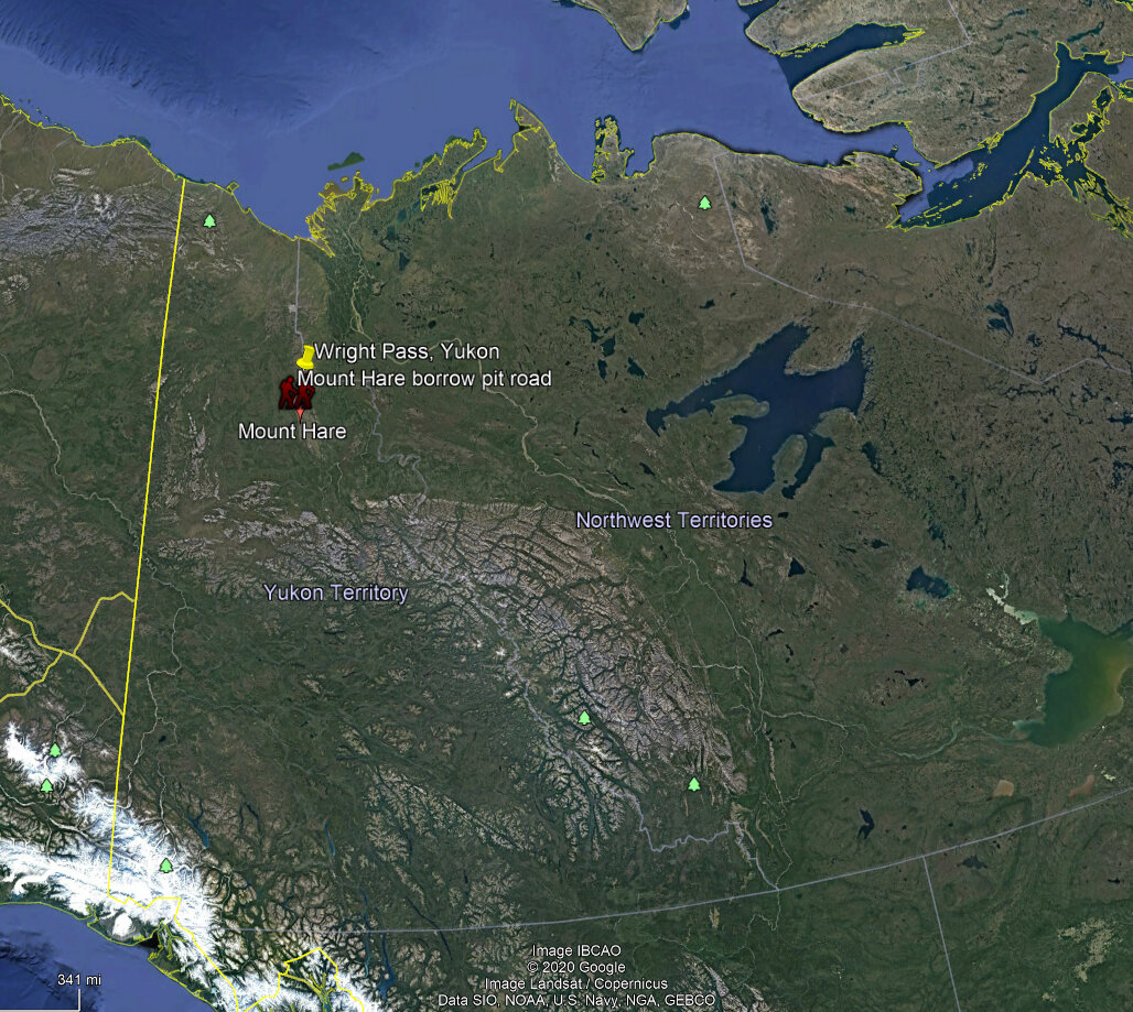
Photo 5: Google Earth image illustrates the location (red hiker symbol) of the intersection between the “borrow pit road” with the Dempster Highway, northern Yukon, Canada. The “borrow pit road” leads east to a shale gravel pit and is a good parking and staging area for hikes to Mount Hare area.
Have A Question About This Note?
Andy Fyon, June 19, 2020